Debug Mode
This function allows users to debug both the map and the coordinate system of the map. It adds the following visuals to the map; tile outlines, projection center, layer extents, and a debug panel that display's the mouse's current location in the various coordinate systems.
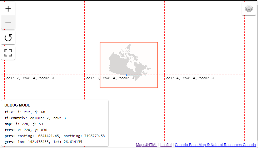
- The dotted red line represents the tile boundaries at the current zoom level
- the solid red line represents the layer's extent, if there are multiple layers the solid line may be a variety of colours
- The bottom left panel displays the current mouse's position
Accessing Debug Mode
Map's Context Menu
Debug mode can be enabled through the map context menu (right-click or Shift-F10):

Map's API
Toggling debug mode can also be done through the viewer's API, see the toggleDebug() method for more.